Waterway Guide FAQs
- I work for a marina or service facility. How do we update our information on your website?
- How do I submit a new Point of Interest on the website?
- How do I cancel and get a refund on my in-app purchase?
- When will I receive my BoatUS membership benefit from registering on your website?
- How do I access my Digital Guides through the website?
- Why should I buy a new printed Waterway Guide every year?
- Where can I buy Waterway Guide products?
- Who is Skipper Bob?
- What can you offer those planning to complete the Great Loop?
- Why don’t the Bahamas printed guide and Mobile App match?
- How does Waterway Guide's content get updated?
- What is the difference between the Mobile App and Waterway Explorer on the website?
- How is the mobile app different from the printed Waterway Guide?
- What type of information does a Waterway Guide cruising guide include?
- Why do I need a Waterway Guide?
- How do I access my guide purchase in the Waterway Guide Mobile App?
- How do I bookmark pages so they're easy to find later?
- How do I download pages of my guide in the Mobile App so they're accessible when I'm offline?
- Can I return the print product I purchased and get a refund?
- How can I view schedule deviations or delays at bridges and locks?
- Why can't I see charts in the Waterway Guide Mobile App?
- Do I need to sign up for an auto-renewing subscription if I want digital guide access?
- How many devices can I load my Mobile App purchase onto?
- What is the difference between the Southern guide and the Florida Keys guide?
- What does MLLW mean?
- Where can I find the Lake Okeechobee Lake Stage?
- What does 'G' represent in "G37" or 'R' in "R8"?
- Are the Waterway Explorer charts displaying depths in feet or meters?
- How do I change the email address on my account?
- Why do I not see any fuel prices listed in "Fuel" view? They all say "Call."
- How do I submit a review?
- Are all of the Waterway Guide cruising guides updated annually?
I work for a marina or service facility. How do we update our information on your website?
All marinas listed on the Waterway Guide website and in the Mobile App have the ability to log in to update their own information.
To access your marina's listing:
- Go to www.waterwayguide.com/business-search which can also be accessed via the "Marina Login" link in the website's footer.
- Type your business name into the search box and select it from the drop down menu that appears.
- Enter your password and click Login. There is a "Forgot Password" link that sends a message to the marina email address on file in case the password needs to be reset.
Once logged in, review the information on your listing, make any necessary updates, and add any information that may be missing.
Be sure to click one of the blue "Update Marina Info" buttons spaced periodically throughout the page when you are done making changes to lock them in.
How do I submit a new Point of Interest on the website?
You must be logged into waterwayguide.com to submit new points of interest. If you do not already have an account, you may create a free one by filling out the registration form.
Follow these steps to suggest a new Navigation Alert, Marina, Service, Anchorage or Free Dock:
- Locate the icon that looks like a pindrop with a plus sign on it in the lower left corner of the Explorer. See below for a screenshot of what that icon looks like.
- Click or tap on that pindrop icon, then select the type of point of interest you would like to submit - Navigation Alert, Marina, Service, Anchorage or Free Dock. You will see the pindrop icon change to the type of icon you selected.
- Click or tap on map in the exact location you'd like your new point of interest to be placed.
- Once a location is selected a popup form will open. Fill out the required fields and hit Submit.
Your suggested point of interest will then enter our review process and we will contact you for additional information if needed.
How do I cancel and get a refund on my in-app purchase?
If you made an in-app purchase of Library content in the Mobile App, any cancellations and refunds must be requested via Apple or Google. Please see below for instructions on that process for both companies.
Apple
Google Play
When will I receive my BoatUS membership benefit from registering on your website?
IMPORTANT NOTE: You must be a new BoatUS customer (not a previous member) and have a US mailing address in order to receive this offer.
BoatUS processes new applications from our website monthly, so it could be 30 days until the Membership is processed. Once your membership is created, you will receive an email notification containing your Membership number and a card kit will be mailed out. Card kits typically take 10-15 business days to receive after the Membership is created.
You can always view and print your card before the kit arrives by logging into your BoatUS account with the Membership number contained in the confirmation email you'll receive from them. To create an online BoatUS account, please go to: BoatUS.com/account and click on Create Account. Once logged in, follow these steps:
- Click on View Membership Details
- Click on Edit Contact Information
Once your account is created, you'll have access to the self-service portal where you can view and print your Membership card and update your contact and credit card information, among other things.
As a reminder, your BoatUS membership will include:
- 6 issues of award-winning BoatUS Magazine filled with boating travel, news, stories
- Exclusive rewards at our retail partner West Marine
- Save on BVI charters, Star Clippers Cruises, rental cars and hotel travel nationwide
- 24/7 dispatch for on-the-water and on-the-road towing
- Discounts at marinas, repair facilities, bait & tackle shops, and more
- FREE BoatUS App -- Call for a tow, show your location and more
- Ability to add discounted towing to your complimentary membership
How do I access my Digital Guides through the website?
If you purchase a Digital or Print+Digital subscription through the Waterway Guide Ship Store, you will have access to read a digital version of your guide through a web browser (i.e. Chrome, Safari, Edge, Firefox).
We recommend that you use a laptop or desktop computer when viewing the guide via a web browser. It does not always perform as expected on mobile devices (tablets and phones).
Here are instructions to access your digital guide through a web browser:
- Visit www.waterwayguide.com.
- Locate the "Login" button in the top right corner of the page.
- Log into your account with the same email address used to purchase your subscription.
- If unsure of your password, use the "Forgot Password?" link.
- Once logged in there are two places to access guide content.
- Member Profile Page:
- Click on your name in the top right corner of the website, then "Your Profile."
- Inside the Member Profile, click on the "Guide Content" tab for all content you have access to.
- Explorer:
- Visit the Explorer using the link at the top of the website.
- Along the top of the map there is a "Read Chapter" link which opens content for the current map view.
- Click on the guide name to the left of "Read Chapter" to jump to a different guide.
- There are nearby Inlet and Goin' Ashore links available in the popups when clicking on map icons.
- Member Profile Page:
NOTE: If you purchased a guide as an in-app purchase directly through the Apple App Store or Google Play Store, your purchase is only available through the Mobile App. You will not have access to view guides through a web browser as described above.
Feel free to drop us a note if you have any questions or feedback on this service: support@waterwayguide.com
Why should I buy a new printed Waterway Guide every year?
We update annually and you should too!
The most common inquiries we receive are from people looking at older guides with outdated information, mostly regarding navigation and marina amenities. Ensuring you're looking at the most recent edition will help address that issue.
Where can I buy Waterway Guide products?
All editions of the printed Waterway Guide plus the digital versions are available for purchase online in our Ship Store and on Amazon, Bluewater Books & Charts, Landfall Navigation and from other select resellers. They are also available at West Marine and in some marina ship stores.
Other titles available in our Ship Store include all Skipper Bob publications, the ICW Cruising Guide by Bob423, Anchoring: A Ground Tackler's Apprentice by Rudy and Jill Sechez, Coastal and Offshore Weather, the Essential Handbook by Chris Parker, Explorer Chartbooks, American Sailing Association training guides, and a series of Caribbean cruising guides.
Who is Skipper Bob?
The late Skipper Bob and his wife, Elaine, cruised over 44,000 miles while living aboard both a trawler and a sailboat. They traversed the ICW several times and completed the Great Loop, taking time to explore the various lakes, bays canals and channels along (and off) the route.
He took scores of notes and kept detailed logs, which were the basis for the series of nine detailed planning and cruising guides, which are now part of the Waterway Guide catalog and are available in our online Ship Store, as well as in the Mobile App as digital products.
Publications include Anchorages Along the Intracoastal Waterway, Bahamas Bound and Cruising the New York Canal System, among others.
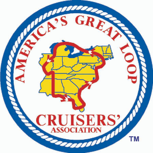
What can you offer those planning to complete the Great Loop?
We have a section of the Waterway Guide Ship Store dedicated to Great Loop resources, including the Skipper Bob and Waterway Guide publications you need to make your trip a success.
A good place to start is Skipper Bob's Cruising America's Great Loop, which covers the trip up the East Coast, across the Great Lakes, down the Mississippi and Tenn-Tom Canal to the Gulf Coast, and across the Gulf Coast to Florida. It discusses what charts and cruising guides you need, how to schedule the trip, what to expect and when and where to go. Alternative routes via the Great Lakes are also outlined in detail.
Additionally, Waterway Guide and Skipper Bob are sponsors of America's Great Loop Cruisers' Association (AGLCA) and provide Great Loop planning resources at AGLCA events.
Why don’t the Bahamas printed guide and Mobile App match?
Waterway Guide Bahamas Land and Sea, available exclusively in the Waterway Guide Mobile App, is a comprehensive digital cruising guide written by cruising expert Addison Chan. This living digital resource is available exclusively within the Waterway Guide app and is the ultimate guide for navigating and anchoring in the waters of the Bahamas. The guide is meticulously organized comprising anchorages, location descriptions, cruising routes and other invaluable advice for boaters. Approach and aerial photos from Chan's many years of on-the-water experience in The Bahamas are also included throughout the 15 chapters to enhance situational awareness of locations and positions.
The Waterway Guide Bahamas Edition includes some of the same information but follows the format of our other guides with a focus on navigation, marinas and anchorages. It is available as a printed guide AND as a stand-alone resource on the app. It covers provisioning and preparing to go, weather concerns and safe travel and day-to-day living including staying connected, transportation logistics and business practices. Most importantly, it details legal requirements such as customs and immigration procedures and ports of entry. It also includes a special section on crossing the Gulf Stream.
When you purchase a Bahamas Complete Digital Guidebook or the Bahamas Complete Print PLUS Digital Bundle from the Ship Store, you are essentially receiving two cruising guides for the price of one - Waterway Guide's Bahamas Edition AND Addison Chan's Waterway Guide Bahamas Land and Sea.
How does Waterway Guide's content get updated?
Waterway Guide employs on-the-water cruising editors who scrub, update and edit each new edition of our guidebooks, mobile app, database and other media platforms.
Additionally, we are in constant contact with our listed marinas and service providers, and we cross reference our data with tourism bureaus, AquaMap and Explorer Chartbooks and local knowledge.
We have also partnered with well-known cruising experts such as Addison Chan (author of Waterway Guide Bahamas Land and Sea) and Bob Sherer (author of ICW Cruising Guide by Bob423) for detailed navigation updates and alerts. Frequent updates on the depths through shallow areas are provided from Bob423 and detailed in Waterway Guide navigational alerts in AquaMap.
Finally, we rely on cruiser-submitted reviews and updates, but unlike other crowd-sourced products, submissions are vetted by the Waterway Guide staff using sources such as the U.S. Code of Federal Regulations, U.S. Coast Guard Local Notice to Mariners and Light List, U.S. Army Corps of Engineers, local Departments of Transportation, the New York State Canal System and Parks Canada, among others.
What is the difference between the Mobile App and Waterway Explorer on the website?
Much like the mobile app, Waterway Explorer allows you multiple options for planning your boating exploration. You can search by planning map, guide edition or destination. Verified marinas, services, anchorages and free docks, bridges and locks, navigation alerts and fuel pricing are shown on the interactive trip planning map. The map includes Aqua Map overlays as well as street and satellite views. This trip planning tool allows you to compare marinas, figure mileages or search by latitude/longitude. Waterway Explorer is available anywhere there is a WiFi connection. No subscription or purchase required.
How is the mobile app different from the printed Waterway Guide?
The app provides multiple ways to plan your next adventure.
You may choose to start with "Plan Your Trip," which is organized by Waterway Guide edition so you can see all the resources for a cruising destination that we offer at a glance–from Waterway Guide and Skipper Bob editions to select Preferred Destinations and Goin' Ashores.
Or you may navigate directly to a specific edition of the guide, where you can select a region on the planning map that is directly linked to the relevant text.
Finally, you may choose to use the robust search feature to find nav alerts, fuel pricing, and marinas and services by state.
In addition to embedded links to verified marina, services, anchorage and bridge and lock information listings, the app includes the latest waterway news and a searchable knowledge center with boater tips and education and preferred destinations.
The app is updated daily and pages of content can be downloaded for offline viewing.
What type of information does a Waterway Guide cruising guide include?
The Waterway Guide cruising guides provide regional planning charts, detailed navigation, marina and anchorage options, as well as what you can expect to find ashore (attractions, services, etc.) in select localities. Aqua Map or Explorer (for Bahamas) chart excerpts are provided in the printed guides to assist skippers when coming into port, as well as aerial and on-the-ground photography for situational awareness. Featured and suggested cruising destinations round out the offerings.
The Skippers Handbook is included in all editions of the printed Waterway Guide and as a stand-alone resource on the app. It covers such topics as port security, customs reporting procedures, rules of the road, VHF communications, weather tips, bridge and lock basics, trip distance charts and GPS waypoints. It also includes bridge and lock schedules and detailed inlet descriptions (where applicable).
Why do I need a Waterway Guide?
We realize there are numerous options available to cruisers when planning a boating trip, but none offer the comprehensive coverage provided by Waterway Guide. We have been producing guides for boaters for over 75 years and as the "Cruising Authority," we set the standard for the industry.
Much like a travel guide for motorists, Waterway Guide provides mile-by-mile details about the waterways of the U.S. East Coast, Gulf Coast and Great Lakes through our printed guides, mobile app and interactive website. Going on a boat trip without Waterway Guide would be like taking a roadtrip without a map.
How do I access my guide purchase in the Waterway Guide Mobile App?
Thank you for subscribing to a digital Waterway Guide! Please follow these instructions to access your guide inside the Mobile App:
- Download the Waterway Guide Mobile App from your App Store:
- Log into your account with the same email address used to purchase your subscription. If unsure of your password, use the "Forgot Password?" link.
- Tap on the "Library" tab along the bottom of the screen.
- Tap on the cover image for the guide you would like to read and navigate the Table of Contents to identify where you would like to begin reading.
If, after following the steps above, you are still being asked to subscribe when tapping the image of the guide you purchased, please do the following:
- Tap the "Home" tab at the bottom.
- Tap the profile icon in the top right corner.
- If your profile page does not list any subscriptions, tap the "Refresh Subscriptions" link.
- Once the page refreshes, if you see your subscription listed on the page please proceed to the "Library" tab and try opening your book again.
- If there are still no subscriptions listed on the page, contact us at support@waterwayguide.com for further assistance.
How do I bookmark pages so they're easy to find later?
If you anticipate being in an area with minimal or no service, pages of guide content can be downloaded in advance so they're still available when your service disappears.
On every book page there are icons along the bottom for navigating, downloading, and bookmarking content:
- Use the Prev and Next buttons to navigate to the previous or next pages of content inside your book.
- To save a page for offline access, tap on the download icon at the bottom of any page (right icon, shaped like a down arrow).
- To bookmark pages of content for easy access, tap on the bookmark icon at the bottom of any page (center icon, shaped like a bookmark).
- To access your previously bookmarked pages, tap on the book icon at the bottom of any page (left icon, shaped like a book with a bookmark on it).
How do I download pages of my guide in the Mobile App so they're accessible when I'm offline?
If you anticipate being in an area with minimal or no service, pages of guide content can be downloaded in advance so they're still available when your service disappears.
On every book page there are icons along the bottom for navigating, downloading, and bookmarking content:
- Use the Prev and Next buttons to navigate to the previous or next pages of content inside your book.
- To save a page for offline access, tap on the download icon at the bottom of any page (right icon, shaped like a down arrow).
- To bookmark pages of content for easy access, tap on the bookmark icon at the bottom of any page (center icon, shaped like a bookmark).
- To access your previously bookmarked pages, tap on the book icon at the bottom of any page (left icon, shaped like a book with a bookmark on it).
Can I return the print product I purchased and get a refund?
Yes, you may return your print product(s) for a refund.
If your print products were purchased through the Waterway Guide Ship Store, please contact our Support Team at support@waterwayguide.com for further instructions. Once the return is received a refund will be issued on the print product(s).
If your purchase was through a different retailer (West Marine, Amazon, etc.) you must reach out to that company in order to return the product and receive a refund. Waterway Guide is unable to issue refunds on purchases from other vendors.
If there are problems due to printing errors or damage during shipping, Waterway Guide will replace your product with a new one at no additional cost. Contact our Support Team at support@waterwayguide.com for further instructions.
How can I view schedule deviations or delays at bridges and locks?
Standard schedules are posted on the individual bridges and locks on Explorer at www.waterwayguide.com. Clicking on the respective icon will display the schedule on the left information panel. You can also click the yellow "Full Listing" button on the popup to open a separate page listing all the available information for that bridge or lock.
Bridge or lock schedule deviations or delays are typically posted as a Navigation Alert displayed near the bridge or lock in question.
Switch over to the Navigation Alerts mode using the dropdown menu along the top of the map to view all available alerts:
To locate a specific schedule change alert, you have two options:
- Pan the map to the location of the bridge or lock you're looking for and scan for nearby navigation alerts.
- Search for the name of a specific bridge or lock in the Search box along the top of the map.
Why can't I see charts in the Waterway Guide Mobile App?
Waterway Guide does not offer navigation charts in the mobile app. However, if you visit the Explorer on www.waterwayguide.com there is an Aqua Map charts layer available in that tool in order to view water depths, navigational buoys, and more.
Do I need to sign up for an auto-renewing subscription if I want digital guide access?
All of Waterway Guide's digital publications are set up for automatic annual renewal by default. However, you can cancel at any time and still have access for the full year that you initially purchased.
If you only want one year of access and not a recurring charge, go ahead and purchase the digital subscription frmo our website. When the transaction is complete, log into your profile at waterwayguide.com and hit the yellow "Cancel" button next to your subscription. That will cancel the renewal but allow you to keep that full year of access.
How many devices can I load my Mobile App purchase onto?
As long as you log into the same Waterway Guide account that was used to purchase the digital content originally, the answer is "unlimited!" Digital versions of the Waterway Guide are linked to the email address that was used during the purchase process, so log in using that same address on any device, iOS or Android.
What is the difference between the Southern guide and the Florida Keys guide?
The Waterway Guide Southern Edition covers the entire state of Florida and the Gulf Coast west to Bay St. Louis, MS. The navigation, dockage, anchorage and Goin' Ashore information for the Florida Keys Edition is pulled directly from the coverage in the Southern guide, so it's the same in both publications. The Florida Keys Edition, however, also includes bonus chapters dedicated to adventures in the Florida Keys, including: Snorkeling & Diving; Kayaking & Paddleboarding; Hiking, Biking & Birding; and Sportfishing.
If you'll only be boating in the Keys that would be the recommended guide, but if you're traveling elsewhere in Florida or traveling both coasts, the Southern Edition will likely fit your needs better.
What does MLLW mean?
Where can I find the Lake Okeechobee Lake Stage?
Visit the U.S. Army Corp of Engineers, Jacksonville District, website at the link below to acess the most up-to-date information about the Lake Okeechobee Lake Stage.
What does 'G' represent in "G37" or 'R' in "R8"?
The 'G' and 'R' indicate the color of the channel marker; 'G' for Green and 'R' for Red.
Are the Waterway Explorer charts displaying depths in feet or meters?
Our online charts on the Waterway Explorer are provided by Aqua Map. That company uses NOAA, USACE, USCG, and other data sources for depths, ATONs, navigation information, LNMs, MSIBs, Light List, etc.
The data is converted to feet for display in Waterway Guide's online Explorer. In the Aqua Map mobile navigation app, there is a menu option for displaying in feet or meters. The conversions by Aqua Map are from meters to feet, and as a result tenths of a foot are often displayed.
How do I change the email address on my account?
In order to change the email address on your account, please contact our Customer Service team at support@waterwayguide.com.
Why do I not see any fuel prices listed in "Fuel" view? They all say "Call."
Waterway Guide offers a program for marinas to opt in to reporting their fuel prices on a weekly basis during their boating season. During the winter months, the Great Lakes, Northern and Chesapeake Bay areas stop reporting pricing since boating has, for the most part, stopped in their areas for the season. During that off-season the Waterway Guide Explorer website map and mobile app will display "Call" for those businesses since they may or may not be open. Pricing reports resume for those regions in the spring (April/May).
For marinas who do not opt into the weekly reporting program, you will always see "Call" displayed instead of pricing on the website and in the mobile app.
How do I submit a review?
You must be logged into waterwayguide.com to submit reviews. If you do not already have an account, you may create a free one by filling out this registration form: https://www.waterwayguide.com/member/register.
Follow these steps to submit a review for a marina, service, anchorage or free dock:
- Locate the icon for that business, anchorage or free dock on the Explorer.
- Click on that icon to open the popup box, then click on the "Reviews" link.
- On the Reviews page that opens you'll see a form. Fill out the required fields and hit Submit.
Your review will then enter our review process and we will contact you for additional information if needed!
Are all of the Waterway Guide cruising guides updated annually?
The Northern, Chesapeake Bay, Mid-Atlantic, Southern and Bahamas guides are all updated annually. The others are roughly every other year or on an as-needed basis.